StreetComplete
StreetComplete finds missing map data in your vicinity and displays it on a map as quests. Solve each quest by visiting the location on-site and answering a simple question to update the map. The info you enter is directly added to OpenStreetMap in your name, without the need to use another editor.
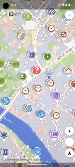
You can browse the list of quests. There are more technical details at StreetComplete on the OpenStreetMap wiki and at StreetComplete’s GitHub page.
As of mid-2026, StreetComplete is only for Android, but there has been substantial progress toward an iOS version.
“Let’s make it simple and fun for non-experts to spend a moment improving a pool of knowledge kept open for the whole world.” What a wonderful idea. As soon as I read about StreetComplete, my heart ached with nostalgia for the earlier days of the web.
If this was helpful or enjoyable, please share it! To get new posts, subscribe to the newsletter or the RSS/Atom feed. If you have comments, questions, or feedback, please email me.